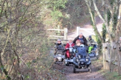
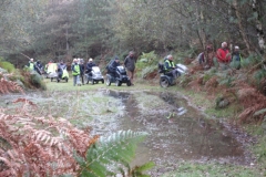
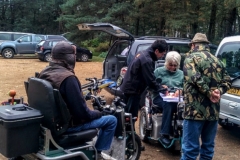
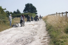
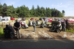
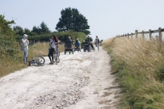
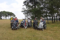
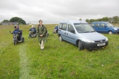
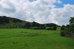
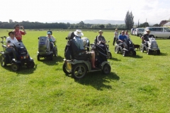
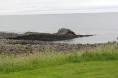
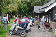
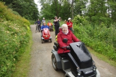
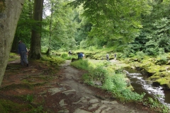
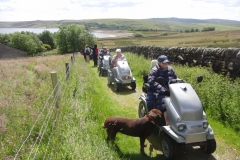
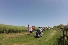
Coming after a very cold spell and then a week of rain we were delighted to be rambling on the one sunny day of December so far – and it was reasonably mild too. After negotiating some tricky sections of track we emerged into the sun at St Ann’s Knoll for mince pies and coffee. A steep climb up the zig-zags followed leading us right to the top of Worcestershire Beacon, the highest point in Worcestershire. After drinking in the views for half an hour we made our way down to the col where were sheltered from the breeze which we had on the top. The toilet tent was deployed and we settled down to have our lunch. As we had time in hand we deviated a little from our normal return route and went around Sugarloaf Hill. As we turned a corner and started heading back to Worcestershire Beacon some of the more aware members of the party said “hang on, we’re going back the way we came” and sure enough we were soon back at our lunch stop. Carrying on down this time we were soon back at St Ann’s Knoll and then carefully driving past the water-worn gullies cutting into the path before returning to our cars. A brilliant ramble with great company; thanks to all who came. JC
34 Photos
REGIONAL RAMBLE DOWNS LINK SECTION 1 - SOUTHWATER COUNTRY PARK TO PARTRIDGE GREEN All this month we kept our fingers crossed for good weather, and were so lucky as it was even better than had been promised by the Met Office. The morning was a typical wintery, sunshiney-lit but cloudy sort of day, but not too cold or windy, so eight of us on scooters and 3 walkers set off from the lovely Southwater Country Park to join the Downs Link which runs from Southwater in a southerly direction until it reaches Shoreham by Sea in West Sussex. This was the first section of the southerly Downs Link which is a particularly nice disused railway route that has been made into a National Trail. Each Section is different, some with more closed in views, some with open countryside and rivers, some with coastal and estuaries to enjoy. The Southern route comprises 3 Sections - Southwater to Partridge Green, Partridge Green to Bramber, Bramber to Shoreham by Sea. They are all very interesting and scenic rambles, the problem is that because of parking and the fact that they are linear routes they can be rather long. They are all Cat 1, but Section 1 was 10.9 miles in total and Section 2 (Partridge Green to Bramber) is 12.5 miles, Section 3 (Bramber to Shoreham) is only about 8 miles. This is unavoidable due to the parking difficulties, so anyone walking, especially Section 2, needs to start training now!!! We were particularly pleased to welcome Judy and Bernard who came all the way from Nuneaton and also Sarah and Peter from Cheltenham. Section 1 is a mix of tunnel-ey tree covered tracks with some open countryside here and there and of course, this time of year you can see through the trees and see much more of the scenery than in the summer. Plus it is so lovely to be travelling on a carpet of rusty coloured, crisp, rustling leaves. We met many cyclists, walkers, horse-riders and families en route and without exception, everyone was very friendly and not a little surprised to see our procession progressing along the Downs Link. We called in at West Grinstead for a coffee break and comfort stop at The Orchard restaurant and tea room. As you may see from the photos there is still the old platform, station name and a signal still in evidence, and a railway carriage that is open on a Sunday and staffed by volunteers to give visitors any info they want. We sat in the old orchard and had our coffee and were pleased to find that an ancient Medlar tree we had discovered on our reccy still had some of its strange fruit laying on the ground. This is traditionally used to make jelly to use in desserts, but can also be eaten if allowed to mellow sufficiently. We reached Partridge Green at 1 o’clock, and descended on Stan’s bike shack en masse, they are always very welcoming and some of us went in to warm up and buy food and the rest of us stayed outside and enjoyed their lovely latte coffee! We can visit them again when we do Section 2, so we look forward to that. We left at about 1.45 as it was definitely getting colder and more cloudy, but no rain at all - thank goodness. We made good time back, but about three quarters of a mile before we reached base we had a battery run out of steam, luckily all the Leaders carry tow ropes but as Arthur has a good, tough TWS he towed the stricken scooter back without any trouble at all. On arrival back at Southwater some of us went into the Country Park to feed the swans, ducks, coots, moorhens, and seagulls on the lovely lake and then had a whizz round the perimeter of the lake, David’s wire mesh covering on the footbridges is a great improvement and we just had to test it out as he campaigned tirelessly to get the old scrappy chicken wire replaced as it was prone to cause punctures, and could even injure dog’s paws etc. We would like to thank David for planning the ramble, and also all who came - some from afar - it was a really great day and we are looking forward to the next Section of the Downs Link. Don’t forget to get in training! Val and Bob.
46 Photos
Andrews Mare - 20.10.2016 We were lucky once again regarding the weather, although it was very cold to start with ... but the main thing was it was dry. We went up to the Canadian War Memorial into the inclosure and past the sunken lake - possibly a crater, not sure - and down Mogshade Hill to the ford and bridge, which 3 years ago on this ramble was being repaired and we had to turn back. A very pretty area in the middle of the forest. Then on up the hill which overlooks Fritham Cross and Lucas Castle, a deep valley which is bordered in the distance by the A31. Nice tracks, with a little uneven-ness and I\\\\\\\'m sure we all thought we had conquered the challenging bit that Di had warned us about, but not so, as we then came to Admiral Murray\\\\\\\'s passage, named after Admiral Murray who was killed whilst out hunting, which leads down to a deep valley called Withybed Bottom and Long Brook. This was extremely steep and great care had to be taken going down, at the bottom was a little footbridge but then a tough and rutted uphill section that took quite a while to get up, a very difficult bit near the top as well, but we all survived! We were then at Foxhill Pond which is used as a model boating lake, and is very picturesque into the bargain and we were treated to a flypast from 3 chinooks as well just as a special treat. We lunched there, then went round the pond before continuing down some nice grassy, but wet and muddy, tracks which joined the route we followed from the ford in the morning. Back at the ford most of us went through, always too tempting to resist. Then on up some pretty forest paths and tracks to the Canadian War Memorial again and back to Bolderwood and our cars. This was the last ramble of the season and some of the group went onto the pub for a meal before going home. A ramble well worth doing with varied scenery and challenging bits here and there. Thanks Di, and once more thanks to our volunteers and walkers who help so much, especially on the awkward bits! Val & Bob
45 Photos
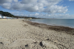
Steamer Point - 19.10.16 A beautiful Autumn day here in Hampshire, one of those lovely zingy, bright and uplifting times that made perfect conditions for our ramble along the coast from Highcliffe Castle to Mudeford Quay. 16 of us and accompanying walkers set off, unfortunately we had to go along the pavements for about a mile as the zig zag path that leads down the cliffs from Highcliffe Castle to the beach is under repair due to subsidence, so the route had to be altered to enable us to get to the Castle. However, we could see how the other half live, what some impressive houses we passed! Highcliffe Castle itself is a very historic building and was ravaged by fire in the last century but is now a popular heritage centre and used as a venue by many local people. We had a coffee break here overlooking the sea and then wended our way through Steamer Point Nature Reserve where we could then gain access to the beaches that lead to Mudeford Quay. It is a really beautiful coastline as the photos show, and the sea was a pearly blue and crashing gently onto the sand. The beaches are just pure sand and there were plenty of people walking and enjoying the lovely October sunshine both outside their beach huts and along the promenade. We had lunch at Mudeford Quay which is really interesting with all the lobster and crab creels on the jetty, and on these creels are hundreds of little tweeting starlings picking them clean, and some of which are so tame they sit on your scooter and chat. It overlooks Mudeford Spit, the home of some of the most expensive beach huts in Britain, some selling for an unbelievable £250,000. There is a tide race between the quay and the Spit, but this was quite quiet today, sometimes it is really fierce and the boats fight to make headway through the current. We had to retrace our steps back, but a treat for us all was an ice cream en route! This ramble is always beautiful whatever the weather, but with the sun out it is really special. Thanks to all who came both for the ramble and to walk and to be there to help in case it was needed. Hopefully, it won\'t be long before the zig zag path is repaired and we can once more get to the part of the beach we had to miss this year, but better to be safe than sorry, as they say! Val & Bob
37 Photos
SOUTHERN REGIONAL RAMBLE - FOXBURY, EAST WELLOW, HAMPSHIRE This is a restoration project by the National Trust, with help from grants from the Lottery Fund, to restore a site that was previously a conifer plantation to its natural habitat of heathland, ponds and woodland and it is already becoming a great success with increasing sightings of Dartford Warblers, Nightjars, Cuckoos as well as Buzzards and other birds of prey and many other species inhabiting the area which is also flourishing with the growth of heathers, flowering gorse, orchids and many other wild flowers. There were 6 of us on this regional ramble on a rather cold October morning and one of the first things we saw were two deer running across the track ahead of us, which is always a rewarding sight. This is a 150 hectare site with over 5 miles of tracks winding their way through the varied scenery. It has extensive views over the Southampton area as well as some wooded areas and thousands of trees have been planted, with a large input from local people, which in time, will become coniferous wooded areas to blend with the heathland. Jake, the Ranger for the NT, was most helpful and met us in the car park and we then spent the rest of our time there wandering through the tracks, we had our coffee break in their education area where there is an excellent new compost loo and a large classroom “pod” as many of the local schools go there to experience the freedom and atmosphere of this unique place. Entry to Foxbury is by appointment only as it is a restoration project and we had the whole place to ourselves apart from a gentleman and the lady Ranger, Catherine, who were investigating the bushes and grasses to see what spider species were present, when we met them they had found a colony of unusual beetles which they were very pleased about. We proceeded through the tracks until lunch when we found a lovely open field which was ideal. The dedication of the Rangers, and the local population of nearby East and West Wellow, is making Foxbury into a very special place and it is fascinating to see how it has progressed since my last visit about 5 years ago. We hope to return on a lovely Spring day to enjoy another trip round Foxbury. It is an easy ramble on good tracks with only one steep hill so is very relaxing. Our thanks to the National Trust, who in this part of the world seem to fall over backwards to help us and encourage our visits to their properties. Val & Bob
20 Photos
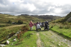
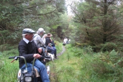
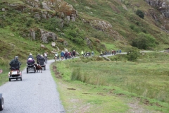
The weather changed dramatically for this ramble, from warm and balmy the day before we had fresh, autumn like, breezy and bracing conditions today. A great gathering again, these rambles have been so popular. We met in the lovely little village of Capel Curig in the middle of the mountain range that forms Snowdonia. Records show this coach road was used by travellers as early as 1639, all I can say is if they travelled by coach on this track they must have been very tough as it is very bumpy! It was a turnpike road until Thomas Telford undertook the building of the present A5, and work started on this in 1815 and the old coach road runs parallel with it nowadays. This is a beautiful ramble through the mountains of Moel Siabad, Y Glyderau and Y Carneddau with Snowdon very nearby. With heathland, rocky outcrops and mountain streams on either side it is very atmospheric and spectacular. It is a quite challenging ramble, not particularly hilly but takes a bit of care and skill to negotiate the many bumps and humps along the way. Part of the track had been washed away and it was only just wide enough for us to get through, but we all managed it without any casualties. We had coffee break near a campsite sheltering by some trees, and there were some very hardy souls camping in tents in a field, but all mod cons up at the farmhouse nearby, loos, etc. It was extremely windy and we all needed coats and hats to keep us from the elements, but it was very refreshing to say the least. From coffee we went on to the ford about a mile away and had some fun crossing it, some had more fun than others! It was a bit rocky and took a bit of negotiating in places. Then back to lunch at the same campsite area where we found some shelter behind a line of trees in a lovely green field. The return trip was in some ways easier as much of it was downhill, as is the way with there and back rambles sometimes. The advantage of there and back is that you see the same view but from a completely different angle so it is just as interesting. The highlight of this ramble was when all of a sudden a huge transport plane appeared, flying very low through the valley - it really was a very thrilling experience. This ramble is very special I think, very enjoyable, quite challenging but do-able with fantastic scenery - what more could you ask for! Again, you can feel the history attached to this wonderful old coach road as you go along it, and try and feel how difficult it was for our ancestors to travel in those days, what a huge effort it must have been. This was our last ramble of the Welsh Tour 2016 and the whole week was really great - thanks to Terry and all the others, i.e. the volunteers, walkers and all who helped Terry lead such a super ramble. V and B.
28 Photos
Our third ramble of the Welsh Tour and it was a really lovely day. We had a beautiful ride from Betws y Coed through Capel Curig and onward to Beddgelert with mountains and lakes on either side of us, there was early mist rising from the lakes and low cloud on the mountains which made the scenery even more impressive Beddgelert village is a delightful little place which just seems to appear from nowhere. The car park at Pont Cae Gors soon filled up, but we had a slight delay as there were some directional problems, however we duly set off at about 11.00 o\'clock, crossing over the single track railway which carries the Welsh Highland Railway tourist steam train on sightseeing tours of this beautiful area. Then up a long, narrow, fairly steep and rocky path with deep, mossy woods either side and little streams and the odd small waterfall, very pretty. We then followed forest tracks with glimpses of the odd mountain through the trees until we reached a lovely area overlooking Llyn Llywellyn, a really picturesque lake set high in the woods, we stopped here for lunch as it was such an ideal spot. After lunch we progressed on up to a viewpoint at Cwm Du where we could see Snowdon and a ridge that is very popular with walkers and climbers that made an idyllic backdrop to the area where we were. We had a talk from one of Terry\'s friends with the chance to ask questions which was very interesting. We then took another path through the woods until we reached the steep incline that we had previously come up, it was just as good going down! Then onto our final leg which took us over the railway again, only this time we had a bonus, we could hear the distant sound of the engine and tooting as the train approached, we managed to get pictures of it, and all the tourists were waving madly, after all, it\'s not every day you come across 25 or so Disabled Ramblers waiting to cross the line! This was the end of our ramble and it was a very enjoyable day, and luckily the weather was just perfect. Many thanks again, Terry and also to your loyal friends for this super day. V and B
37 Photos
This is a glacial valley with a bit of everything for walkers and climbers alike. Formed by glaciers thousands of years ago it has high mountains bordering the valley with a very flat floor which used to be a lake but over the milenia this silted up leaving a rather boggy flat valley floor used for sheep grazing mainly, but the area is host to a lot of wildlife as well, see https://visitsnowdonia.info/nant_ffrancon-211.aspx for more info. There was, and still is, slate mining carried out in the valley, as we saw from the gigantic slag heaps, see pics. Again, we all thought the weather was set to be fair but never underestimate a decent mountain range! There was low cloud lurking halfway down the mountains to either side, it was dry though and in fact, the cloud was very atmospheric. We started off from the Visitor Centre at Ogwen Lake and before we left had a very informative talk from one of the Rangers there, she had hoped to accompany us but had broken her hip during the summer so was unable to. There was a series of very steep hills on the first leg which gradually straightened out to a leisurely ramble along the valley floor following the course of the river Ogwen, I then learnt (rather alarmingly!) that it was a \\\'there and back\\\' ramble and these challenging hills would have to be \\\'gone up\\\' instead of down! Keep calm and carry on! We had lunch overlooking the weir at Ogwen Bank where there is work being carried out on a community hydro electric scheme, ie all the local community has been involved in getting the scheme up and running by raising funds and so on, you will see how hard the chaps work by the pics of the digger unloading rocks to roll into the river to create the necessary conditions for the scheme. Poured with rain here, but on the way back the sun came out for us. It was a hard slog back up those steep slopes, but we made it in the end although some of the scooters were hard pushed. One funny thing, going over the last cattle grid I was so pleased to have made it when Bob yelled \\\'your crutch has fallen off into the grid\\\', sure enough just poking through the bars was the tip of my crutch and luckily he was able to tip toe over the bars and just about grab the rubber ferrule on the end. An amusing ending for us to a lovely, picturesque ramble. Thanks to Terry for sharing this with us. V and B.
25 Photos
In spite of the Met Office telling us it was to be a nice day we arrived at Newborough Forest to a very damp, wild and windy start. A very impressive sight too, 25 scooters and many walkers and all in good spirits. One of the highlights of the ramble was to go along the beach overlooking Llanddwyn Bay to Ynys Llanddwyn, or Llanddwyn Island, where there is a wealth of historic stories of ancient times to be heard but today with the fierce wind it was whipping up the sand which made it impossible for us to venture along the shore so we took an alternative route through the beautiful forest which is mainly pine. Apparently, there are a lot of red squirrels in Newborough but we didn\'t see any at all, which is not surprising really as any self respecting squirrel when they saw a brightly coloured column of chattering DR\'s approaching would be bound to find refuge in some comforting treetop! En route through the tracks we were able to glimpse the Island of Anglesey across Malltraeth Sands, and saw the part of the Island where some of our favourite Royals lived for a few years recently. Makes it all seem more real. Part of the trek was quite challenging with some quite deep sandy surfaces and a couple of very steep slopes, which we all managed with great skill and composure, but this is what makes the day more exciting. This was a ramble of 7 miles and was very well led by Dave and Janet, it was their first attempt at running a ramble and it was very organised and well thought out so hopefully it will be the first of many in such a lovely part of Wales. One of the highlights of the day was to see Robin and his wife, Alwyn, on their specially adapted tramper which now has seats for two, lovely to see them both. Great too, to see Sue J looking so well and taking part once more, all very optimistic and positive vibes for the future in both cases. The weather also cleared up after 2 o\'clock, long enough for the waterproofs to be discarded, but by the time we got back to base at 4.30 it was very windy again, but everyone was very pleased with the day. Newborough is very unusual in that it is a forest right on the beach and in places there are \"sand drifts\" just like snow would be blown into the woodland but instead it is sand, some of the photos show this effect. V and B.
25 Photos
Super, clear day for our 9 scooters and 3 walkers. This was a variation on a regional ramble we did last year, but turning right instead of left and so making it a completely different route for a good part of the way. Today on the ponds that form the first part of the trip we saw many dragonflies and damselflies flitting about, always a lovely sight and the best display this year so far. This part of the ramble is quite tricky in that it is quite a deep, sandy track that leads to the right hand turn through a little wood and onto very open forest that seems quite remote. This section is not heathland as such, and is used for grazing cattle so in the wetter months is impassable due to deep mud, also this area in general is very boggy and damp so August is the ideal month if it has been dry enough. On our reccy we couldn’t get over the last of 4 little bridges due to the mud and luckily, on looking at our OS map, we found a little path that led through a magic wood, so completely off piste for us but we could tell that it linked up eventually with the cycle route we needed if it was accessible for us. It was, luckily, so it was nice to lead the group through this lovely natural part of the New Forest. It was then onto the cycle route in Denny Wood and we had lunch in the woodland glade that we would have got to had the last bridge been passable. However, it’s always good to find an alternative and equally lovely way to get to where you want to be, and part of the fun of a reccy and subsequent ramble. The next part of the ramble was partly on tarmac and gravel tracks until we reached the last leg of the ramble through yet another lovely glade and little wood, which then leads onto the final part of the route through the open heathland, the heather is in full bloom at the moment, and with it you get this lovely sweet fragrance which is unmistakable. The New Forest is a sea of purple bloom at present. Again we passed some ponds, rather boggy but still with lots of dragonflies etc. The dogs had a swim and came out rather black looking! Then back to start, four of us went on to do another 3 miles across really open forest to Matley Wood, where we saw quite a lot of ponies. We all had a very enjoyable day - many thanks to those who came, some quite a considerable distance, it is much appreciated. Now for the next reccy! Val and Bob.
55 Photos
Two Rings Regional Ramble - Chanctonbury & Cissbury Rings, West Sussex On the day of the actual ramble we had 13 scooters and 8 walkers, and we were pleased to welcome a new member, Brian, on our trip. A very generous local farmer let us park in his newly harvested field, which was a real treat without the ramble to follow. Our original parking place was cancelled as the cows and their bull didn’t want to be moved, hence the lovely field which you will see from the photos plus the spectacular scenery. Unfortunately, it added a considerable distance to the ramble, from just over 7 miles to nearly 10. Full points to the valiant walkers - not one of whom complained. It was a very hot but hazy day though so the views were not as sharp as we would have liked but still impressive. We set off up the chalky track to meet up with our designated route which led us to Chanctonbury Ring, a lovely track with wild flowers in the verges and hedgerows and beautiful views to either side, once at the ring we had lunch and some of the group went off exploring and managed to get into the ring under the shade of the trees. We hope to do another ramble to Chanctonbury from the village of Washington and will do some more exploring then as well, we will have more time too. After lunch off back down to Cissbury Ring. A totally different hill fort in that you can easily get into the inner circle and actually go round a grassy path the whole circumference of the ring, and it is here you see many other types of flowers that like the chalky soil and general conditions. We had a slight worrying situation in that I lost most of my group!!! I was held up at the entrance and they all dispersed in different directions, however, they all returned safe and sound to a rather irate leader I have to say! Peace restored, and after a lecture, we then did the grassy track and wended our way back to the farm which was some mile and a half away. This is a truly terrific ramble and one of our favourites, it has everything, scenery, wild flowers, wild life (normally), and it’s one we never tire of - the only drawback is the limited parking, so thank goodness for our lovely farmer - many thanks Robert! Thanks to all for coming and making it such a super day, we are now planning another - in the New Forest this time. One to follow in West Sussex in September hopefully. Val and Bob.
34 Photos
It's amazing to realise that this is the fourth ramble in memory of Mike Longbottom a much loved member of DR who did so much for the group. This time some 15 happy Ramblers set off from Hill Barn Stables near the beautiful Lambourn Valley much famed for racehorse training. We were also pleased to welcome Sarah Wright from the Ridgeway Partnership along with us, so she could observe how we coped with the rough going and to see if anything can be improved to aid access to this famous old drove road. Most of us left sunshine behind us at home and it was a grey start at Hill Barn, we were lucky enough to be parked in a lovely wildflower meadow to begin our ramble to White Horse Hill going along the ancient Ridgeway which runs for 87 miles from Avebury in Wiltshire to Ivinghoe Beacon in Buckinghamshire, through the Chilterns. So far we have done under 30 miles of the Ridgeway! Plenty of scope for the next few years, thankfully. We had been forewarned of it being quite a challenging route and we weren't disappointed! After about half a mile the chalk track changed from fairly OK to many deep ruts and deeply worn areas where the rainfall and many years of use had eroded the chalk so that you really had to look ahead to plot your own preferred route. The Trampers could go on a different path to the Supersports, 3 wheelers can put the front wheel in a rut and manage quite well that way, but we all coped very well without mishap, just a good feeling of achievement. The views either side were wonderful, Oxfordshire all around you, Didcot power station was clearly visible, without one of its famous chimneys of course. On the Ridgeway you get a feeling of the ancientness of the area, it has been used for at least 5000 years by travellers and drovers, it's a really special, marvellous old road with the most spectacular views. There are many hill forts along the route too and by lunchtime we had reached the Uffington White Horse. This a highly stylised chalk figure, some 110 metres long, dates from prehistoric times and is formed by trenches filled with crushed chalk. It is reputed to be one of the most ancient horse figures in the country and set a precedent for other white horse hillside carvings, and is a Scheduled Ancient Monument, so of considerable importance. After lunch … the journey back up the ruts! Never so bad going back though, although one person's scooter reared onto its back legs, (you know who you are!) but all was well. It was tricky in places but well worth going, and on a linear ramble you get a completely different view of the scenery on the return trip, so going back you could look over the vast panorama before you and see a different aspect entirely, that is, when you could spare a little concentration from trying to stay upright and not do a sideways roll or something similar. We got back much too quickly it seemed, so that shows how enjoyable it was. There was also many wild flowers, scabious among them, the verges were full of rosebay willow herb, thistles, tall seed heads of cow parsley family, and so on, and we saw a red kite flying above us, also a couple of humans flying kites too up at White Horse hill. Rewarding, too, to see many cyclists and families out enjoying themselves and all very friendly. A high spot for the chaps was the sight of an auto-gyro (as in James Bond apparently!) flying overhead, a very rare sight I am told! A super day, and our thanks to JC for all the reccying and organising involved, so much more involved than meets the eye! Val
28 Photos
New Laund Farm in the Trough of Bowland has a great Tramper route across open farmland. On the first Monday and Tuesday of August John and his mum, Jean host guided walks with rangers Sandra and Dave bringing Lancashire loan Trampers for those who do not have their own. The route gives superb views of the Lancashire fells the terrain is varied from tarmac to tricky cross slopes, a ford and rough farm tracks. This is a working farm with a keen interest in the environment and protecting the wild life and landscape. These walks are not only enjoyable but have an educational aspect John welcomes questions on the why and where. We discussed the decline of the Hen Harrier to a Pasture Topper! Also the very nice menu at the Inn at Whitewell just across the field.
17 Photos
A great Cat 3+ or 4 ramble. A rocky climb past the King & Queen stones, through the wood with all its tree roots and then, take a deep breath and over the edge on 1:1 to begin the descent. Lots of loose rocks to begin with then opening out to give stunning views across the Severn Valley to the Malvern Hills and beyond into Shropshire and Wales. Thanks Andy for two great days out.
33 Photos
The South is still rambling! TWO RINGS RAMBLE CISSBURY TO CHANCTONBURY, WEST SUSSEX. After a super ramble on the 23rd of July with two good friends from DR from Washington, West Sussex to Chanctonbury Ring ancient hill fort, we decided to do it from the other end, that is, from Nepcote where Cissbury Ring is situated. Bob and I set off bright and early on a beautiful day, on this particular chalky track going through the South Downs there is an abundance of wild flowers and clouds of butterflies, mainly fairly small ones, some sort of “skipper” I think, but also on a certain wild plant, Hemp Agrimony, there were many Red Admirals and Peacocks all drinking the nectar, a really lovely sight and worth lingering over. We saw a Yellowhammer sitting on top of a tree which is something always very thrilling, down a track there were a group of partridges in the path, a skylark sitting on a wire fence which seemed totally unfazed by us, so we had a really good look. You get a feeling of very ancient times going up this track and can almost feel the past as you go along, it’s wonderful! On our initial ramble with Sue and Colin on the 23rd we saw a large number of Ghurka soldiers and other walkers all taking part in the 100 mile South Downs sponsored ramble in aid of Oxfam, all were very friendly and polite, but today the 25th it was much quieter. We reached Chanctonbury Ring with no problems and after drinking in the view started back. It was here we saw the Marbled White butterflies as seen in the photos, so pleased as they are fairly rare nowadays. We came across a family of four, Mum and Dad and two youngish children on bikes with a puncture and luckily we had a puncture outfit in our toolkit so were able to help and very pleased to do so, so Halfords here we come for a new puncture kit! Good feeling though. It was on our way back we saw the skylark, all these things that happen make it something to really treasure. Cissbury Ring is one of our favourite places and we visit it many times. Totally different to Chanctonbury, but both are iconic in their own way. The wild flowers here are different to any other place and there were harebells just coming out in profusion and hundreds of other flowers which will take me hours to identify! The path they improved last year, as reported on the website, for us DR’s to gain entry into the Ring has bedded in very well and although steep makes entering the Ring much easier. There is a grassy track all round Cissbury that we can scoot round with wonderful views, a truly super place. There are views as far as Brighton and beyond, as per photos. We hope to run this as a Regional Ramble before long, so that we can share the beauty of West Sussex with others, it makes us realise how valuable our scooters and belonging to DR is to us all. Keep your eyes on the web for information re the ramble! Val and Bob.
29 Photos
Cragside is a National Trust Property which was first built by Lord Armstrong, the great Newcastle industrialist, in 1863 and used by him and his wife, Margaret, as a weekend retreat. In the 1870s they extended the house and lived in it all the time. Margaret was a very keen gardener and the house was surrounded by magnificent gardens and grounds. In the morning we rambled onto the moors above Cragside where there was a circular carriage track the Armstrongs used to travel round to look at the extensive views. We did not ramble along the whole track but we did enjoy some of the views. In the afternoon a NT guide took us on a tour of the estate where we saw more wonderful views, and showed the guide how good trampers are on the rougher tracks. We also saw some of the lakes needed to drive Armstrong’s hydraulic machinery and generate hydroelectricity making Cragside one the first house to benefit from electric lighting, heating and household appliances invented by Armstrong. Thanks to the National Trust at Cragside for looking after us so well, and many thanks to Hugh and Jill Williamson for organising and leading this ramble.
14 Photos
Meeting with Kevin, the National Trust Ranger for the Northumbrian Coast, in the delightful fishing village of Craster, we rambled along a broad grass track on the cliff top up to the magnificent ruins of Dunstanburgh castle which sits on an outcrop of the Whin Sill. Enroute Kevin described the landscape and history of this beautiful area. We circled the castle ruins and stopped for coffee to view the 100 foot high Gull Crag Cliffs with their important kittiwake and fulmar colonies while to the north is the crumpled Graymare Tail or “Crocodile Rock”. At this point Kevin had to unlock a gate to allow us to by-pass a small kissing gate; he has promised to look at replacing the padlock with a RADAR key one. Our route now passed alongside the golf course with a welcome stop at their Clubhouse for lunch. Our return took us along along a quiet lane with a WW2 pill-box. After reaching the farm of Dunstan Square our route took us along the west side of “The Heughs”, yet another outcrop of the Whin Sill. Many thanks to Jill & Hugh for organising and running the ramble and to Kevin for providing such interesting background.
52 Photos
From Guisborough Forest Walkway Visitor Centre, we started along the same route as yesterday. Staying in the woods this time, we reached an open area where we had our coffee stop and started to dry out after a sudden heavy shower. On then to the Blue Lake, a small reservoir once used to power the mining of Alum, Jet and Iron from the surrounding hills. Continuing to Highcliff Wood, we had lunch and then most went up the steep stony track to the Nab where we were rewarded with glorious views across the North York Moors. Our return route took us through what was the model village of Hutton, built to house the miners and now and expensive suburb of Guisborough.
32 Photos
We began by following the track-bed of the Guisborough Railway Branch Line but soon left this to climb through the woods then exit onto Roseberry Common. Soon we reach the foot of the distinctive conical Roseberry Topping. After watching walkers clamber up to the summit, we continued to Aireyholme Farm for lunch by the pond. This was the childhood home of Captain Cook. Returning past Roseberry Topping we turned off our outward route to pass Bousdale Farm where a steep descent took us back to the woods and the Visitor Centre café by the car park. Many thanks to Vic & Ian for finding and running this lovely ramble.
48 Photos
The enigmatic remains of Bolton Priory on the lovely River Warfe provided the backdrop for much of the afternoon of this ramble. However, we began by heading upstream to the often-dramatic Strid, a narrowing of the river from 100 yards wide to only a few feet, where the depth is unknown and no one who has entered the water has left it alive. After viewing this innocent looking gorge from a safe distance, we climbed to Strid Wood tea rooms past the view of Barden Tower painted by Turner. We returned to our starting point at the Cavendish Restaurant for lunch then rambled to the remains of Bolton Priory where we watched visitors crossing the now wide-again river on stepping stones. A good day for ice-creams!
34 Photos
A lovely sunny summer's day for this easy ramble around the reservoir. Set in the middle of the delightfully named Appletreewick Moor, the views all around the reservoir are equally delightful. The ramble around the reservoir provides lots of interest as well as great views. There is the cruck barn, which was preserved when the reservoir expanded, Grimwith House, and the remains of Gate Up – a hamlet which was sacrificed for the reservoir. And we got back before the rain started! Many thanks to Rachel Briggs of the Yorkshire Dales National Park and Yorkshire Water for making this route possible.
50 Photos
A brief shower cooled us all at the start of another warm day. We started by traveling through the private Foxcote Estate and then onto roads which were being repaired - and so we were treated to an escort vehicle. Descending a nicely rutted trac, we soon arrived at Hidcote where the National Trust staff warmly welcomed us into the gardens for lunch.
20 Photos
Another hot and humid day on this outlier of the Cotswolds. A steep and rutted track gave a good Cat 3+ ramble to a lovely wooded section which then opened out at the summit where we had lunch in the earthworks of the iron-age hill fort. A gentle ride down past farmland was a welcome relief to some and the stream in the village pure bliss to overheated dogs. Thanks Andy for two great rambles.
25 Photos
A very picturesque ramble combining valley, lake and coast. From the outskirts of Helston we travelled along the edge of ‘The Loe’, a land-locked estuary created when a big storm threw up a massive shingle bar and which is now the largest fresh-water lake in Cornwall. On reaching the sea we turned west and followed the coast past Vellin-gluz Rocks before turning inland over fields to enjoy a cup of tea at the NT café. Many thanks Greg for coming with us and adding so much interest to the ramble, what a font of knowledge! It was great having you with us.
39 Photos
We set out from Bissoe Bike Hut and rambled along the Cornish Coast-to-Coast path to the Poldice Valley where we explored the remains of tin 7 copper mining and arsenic production. During our return after lunch, at about 14:15, we heard cries for help coming from the hillside above. Five of our walkers scrambled up loose scree to find out what was happening. A man, Paul Lane, had slipped while out walking his friend’s dog. He was hidden by trees and so took some finding. Paul said that there was the sound of a crack from his leg when he fell. He had tried to crawl to the track but couldn’t make it. We phoned for an ambulance which we directed to the nearest point on the track in the valley. The ambulance people then tried to work out how to get to Paul. One pair set out in their 4×4 to try to reach from above. A member of DR escorted the other pair on foot up the scree to Paul where they diagnosed a fractured leg. The ambulance people had no way of getting Paul from the hillside, 150 metres above the track. No helicopter was available due to fog at their base. Our Rescue Trailer was called for by radio and a steep and rough track was found to bring it to Paul. After transferring Paul to our trailer, the ambulance people descended and left us to bring Paul down the track. We brought Paul right up to the ambulance and they departed. Many thanks to all those helping with the rescue – and to the rest of the group waiting patiently. Paul phoned later to say that he had been released from hospital at about midnight and that it was a severe sprain rather than a break.
47 Photos
9/5/2016. 6 miles, Cat 1. Borough Arms, Dunsford, Bodmin along the Camel Trail to Helland Bridge for lunch on ‘The Island’ next to the C15th Pack-horse Bridge. A lovely spring day; wild flowers in bloom, birds singing, sun in the sky and a great group of ramblers. Shame about the shower on the way back but it dried up before we reached the cars. Many thanks to Alexy Van Kimmenade of the Colquite Estate for allowing access to the island.
7 Photos
Very April weather and a cold wind – but good solid paths and, because the leaves were not fully out, lovely views across the valleys. It was a figure-of-eight route so lunch was back at the café - where it rained. Lots of us sat it out bravely but then discovered afterwards there were tables under shelter behind the building! The best weather was in the afternoon and it got quite warm as we climbed steadily through varied woodland paths. A good start to the rambling year
11 Photos
The planned Ashridge ramble was glorious in summer – but then it rained all winter and the broad woodland paths turned mostly liquid. So after a last minute panic to find new ways through we ended up with a route rather better than the first. Very varied landscapes, spring foliage bursting out everywhere … and just enough mud to make things interesting. We even had the chance to use the tow ropes. It could have been a bit warmer but when the sun came out it was fine. Thanks to all you walkers – very visible in the new DR hi-viz jackets – Thanks for seeing us safely across roads, golf courses and mud baths.
19 Photos
