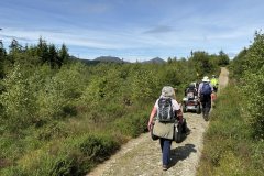
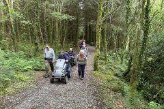
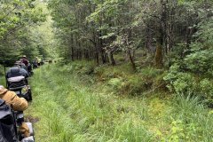
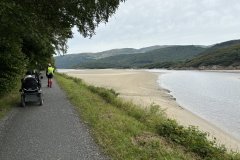
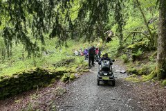
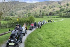
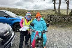
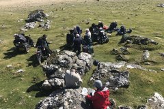
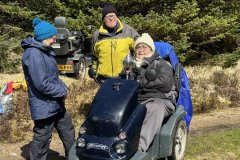
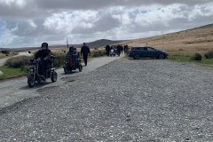
Coed y Brenin Rivers Gain and Eden 19 July 2024 We had had good luck with the weather for the first three days, would our luck continue? The forecast was for bright, sunny intervals and warm. The reality was a lot brighter sunshine causing a quick rethink of the exact location of the morning and lunch breaks. This was our second visit to Coed y Brenin but this time we had a figure of eight route. The first loop started with a gentle climb along forest roads before we turned up on a narrower track with a lot of magnificent vegetation on the forest floor, including lichens, mosses and ferns. Some of the lichens had spread up the trunks and onto the branches. I believe that this could be called a Temperate Rain Forest. Before leaving the shade, we had coffee. After coffee we moved back into the sun to enjoy the magnificent view of several incredibly attractive peaks that should have been the backdrop for our first break. We then proceeded downhill to get within the sounds of the river Gain. From there we travelled uphill while enjoying the views of the other side of the River Gain valley showing the various stages of forestry from mature trees to fully harvested spaces. Lunch was taken at a shady spot before completing the first part of the figure of eight. The second half took us down the “Sarn Helen”, an old Roman road which we came across in the Brecon Beacons tour, to the bottom of the hill. It was noticed that the trees on this hill were significantly taller than any we had previously seen. From there we followed the River Eden which was still showing the benefit of the heavy rains earlier in the week. We also passed an old mill powered by the river and a stream from the hill behind it. Tea was taken at a picnic site right on the banks of the river before returning to the car park via the Visitor Centre. Throughout the ramble the richness and diversity of the flowers and grasses etc in the open spaces and along the side of the forest roads was an immense pleasure to see. Also, we were amazed at the amount of new growth we saw on almost everything, but especially the trees A warm ramble with some wonderful views and sights which really gives one a sense of wellbeing. Looking forward to coming back. Chris N.
18 Photos
Beddgelert Forest 18 July 24 Great weather forecast: bright, sunny intervals and warm. Needless to say, the reality was a little different. Started off chilly and very overcast. We started from the Forest car park, passing over the railway line and then rising through the woods towards the coffee stop. We had a few spots of rain then 5 minutes before coffee it became a drizzle requiring the waterproofs. Of course, by the time we had coffee it stopped. But what a view we had, with all the peaks fully visible with just Snowden still having a cap of cloud, and closer, we could see the railway and the lovely Llyn y Gadair (Lake). Moving on the weather started to improve and the forest started to brighten up. The waterfalls were still much fuller following the storm of Monday night but surprisingly there was little water flow along the side of the forest roads. We also saw the impact of the winds earlier in the year with many fallen trees visible. Such is the impact of nature on the forestry business. Lunch was at the new picnic area alongside the now completed dam. It was very bright and warm, and the lake was very calm. Following lunch, we back tracked and went round the top of the lake to enjoy its full beauty. We also had a complete set of peaks, including Snowden, in full view with some glorious clouds hovering above them. An absolutely stunning view! Time to move on to the challenge of the day: negotiating what looked like a dried-up stream full of rocks and boulders. The success of the challenge was rewarded with tea in the garden of Sue and Gary. They must have the most fabulous view I have seen from a garden, Snowden, and many other peaks in all their glory. We even got a chance to glimpse the steam train as it went round the loop to gain height. Reluctantly we had to move on. On route some of us got a much better view of the steam trains as we were approaching the level crossing. For those who were slow to leave the car park we had the joy of hearing, difficult to see them, the Typhoons from RAF Valley practicing their low-level flying through the valleys. Great day. Chris N.
21 Photos
Coed y Brenin Waterfalls Cain and Mawddach 16 July 24 Well, after almost 14 hours of rain overnight what could we expect? We got bright but overcast, warm but not hot – great rambling weather. The outbound section of the route took us uphill through the lush forest with some good views through the gaps in the trees. Then we started the descent through more open space towards the waterfalls. Coffee was taken with wonderful views across the valley. Many people noted that before long that view would not be there given the speed of growth of the trees. Next came a grassy track which proved to be very wet - surprise surprise given the overnight rain! But with water still on the leaves and undergrowth and a “stream” running down the path there was a very magical feeling about that whole part of the route. To make it even better halfway down we had our first view of the first waterfall, and wow what an impact 14 hours of rain had on the volume of water going over it – spectacular. Having reached the bottom of the valley we followed the river upstream, stopping at various places to get the full benefit of the whole scene with the site and sounds of the rushing water the glorious sight of the overhanging trees etc. Crossing the river we then proceeded to the lunch spot, a nice wide part of the rail with a seat and shelter from the sun which had now appeared. After lunch we followed the river downstream. Then another path taking us across the river with yet another demonstration of the power and beauty of nature. Then we moved to the long and, in some places, steep climb. Everyone was watching the amount of battery power they had left but fortunately only one needed any help. Afternoon tea was taken halfway up, and then a second 10-minute break was taken at the top. Then the final run back to the starting point. Another great ramble with some people saying it was one of the best they had been on. Chris N.
22 Photos
Mawddach Trail: Abergwynant to Arthog 15 July 2024 The morning started with a weather warning for heavy rain from about lunch time. Great start! We started a little early in bright and warm weather by going out through the woods to the old railway track which runs along the bank of the Mawddach river. The tide was out so the view was of lots of sand with the river meandering its way towards the mouth. There were many geese and a variety of other birds including swallows, egrets, black headed gulls, herring gulls and many more. Soon, the bridge across the mouth of the river and the town of Barmouth came into view, with the river flowing into the sea. Following the coffee break the first signs of the rain persuaded some people to put on wet weather gear while others decided to wait a bit longer. By lunchtime, most people were taking some precautions. It was agreed that lunch would be restricted to 30 minutes to try and beat the weather. The beauty of this linear ramble was that the view going back was quite different from the morning view. Returning, we saw the magnificent hills at the head of the river and beyond and the tide covering the sands that had been visible before. The tea break was abandoned with the aim of getting back to base and packed up before the heavy rain arrived. It worked. The rain arrived about 30 minutes after we all left. A very enjoyable ramble with great scenery and that lovely feeling that one gets when enjoying what nature does well – providing a calm environment, even when wet. Chris N.
16 Photos
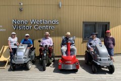
Higham Ferrers Regional Ramble 26/6/2024 Our small group of members set off in warm sunshine from Higham Ferrers with lots of water and sun cream ready as the heat rose during the day. We were led by new ramble leaders David and Chris Drage, who live in the area. First, we headed along the Greenway towards the Railway Museum where one of the volunteers gave us a short talk. We continued towards and over Skew Bridge, which crosses the busy A45, into the Rushden Shopping Centre for lunch in the shade by the lake, finishing with ice creams. The afternoon part of the route went alongside the lakes of the Nene Wetlands Nature Reserve under the trees where we could see the wildlife from the banks and enjoyed regular stops in the shade. Heading back into Higham Ferrers towards the end of our ramble we met children coming out of school. One little boy was very excited at seeing us saying to his mum ‘look there’s a go cart’ running closer he saw the rest of us and shouted, ‘look there are lots of them’. The perfect day was ended in the garden of David and Chris with drinks and biscuits and a little rest before setting off home again with a promise to do another ramble soon. Judy & Bernard David and Chris
10 Photos
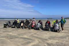
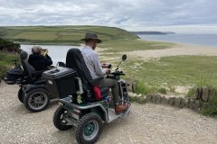
Godrevy – 07/06/2024 A beautiful morning for a beach adventure! Soon after heading out from the Rockpool Café Car Park we came to our first challenge of the day, crossing Red River on a narrow bridge with a small step up and down and a tight turn. Once we reached the passage between the dunes of St Gothian’s Sands Steve guided us through our next challenge of getting down the soft sand to reach the firmer tide washed sand beyond. Our visit was timed perfectly with the receding tide and Steve’s understanding of these sands enabled us to safely move around the vast open space which provided a freedom rarely experienced by mobility scooter riders resulting in a number of ‘doughnuts’ being created in the sand. After this excitement we moved closer to the cliff face where we saw caves and fantastic contorted layers of rock. We stopped for coffee at St Peter’s Point, about a mile from where we had entered the beach, before slowly making our way back to the dunes. Leaving the beach over the soft sand was challenge number three, particularly for the Tramper towing FSU which needed a bit of a push. Our lunch stop was back at the car park by which time the glorious sunshine had been replaced by cloud and a cold wind. Our afternoon ramble took us along part of the South West Coast Path to Godrevy Point over looking Godrevy Lighthouse. From here we continued up hill to above Mutton Cove home to a colony of Grey Seals, but sadly they were not at home today! As the wind was quite cold on the top of the cliff, we took a group decision to return to the car park, stopping off at a sheltered ice van on the way. This ended a very memorable week of rambles. Very many thanks to Steve for arranging and leading four fabulous rambles and to Duncan and Anne, our MSU towers for the week, for all their hard work. Marian & Barry
24 Photos
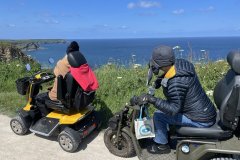
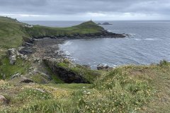
Tehidy Country Park and North Cliffs – 06/06/2024 Setting off from our specially arranged parking area in the north of Tehidy Country Park we headed towards the cliffs above Bassetts Cove. In the bright sunshine the sea looked a vibrant blue as we approached and once we reached the cliff top we looked down on the rugged Cornish coast line with Godrevy Lighthouse in the distance. From here our route took us west along North Cliffs on the South West Coast path, which in one or two places felt like being in a floral corridor where wild flowers had restricted the width of the path. Arriving above Derrick Cove we stopped for a break and cameras came out to capture the stunning coastal views. We then retraced a short section of the route before crossing the road and making our way down a private track to Down’s Farm where Joy, the farmer’s wife, had invited us to her beautiful garden for our lunch stop. After thanking Joy for her kindness, we headed downhill on a quiet road and entered Tehidy Country Park, rambling back uphill in the welcome shade of the trees. At the top of the track a decision had to be made - do we go back to the car park or explore the park further which would take us past the café?! The latter was voted for, so we continued through the park among the beautiful trees, alongside a stream and round the duck pond, dodging the sleeping swan that showed no interest in us at all, before arriving at the café for drinks and ice cream. Refreshed we set off to return to the car park with Steve challenging us to manoeuvre through a kissing gate. A few of the group had struggled through this challenge before Steve revealed he had arranged for the gate alongside to be unlocked! Marian & Barry.
15 Photos
Botallack - 04/06/2024 Today’s ramble was in the dramatic landscape of the wild Tin Coast at Botallack, part of the Cornish Mining World Heritage Site and one of the filming locations for the BBC’s Poldark drama. Setting off from the Count House our route went west, passing the remains of the engine house at Wheal Owles before turning onto a narrower track below Kenidjack Castle, an Iron Age promontory fort, and heading for a disused quarry below the ‘castle’. The quarry provided shelter for us from the unusually cold wind while we stopped for a break to take in the view across to Cape Cornwall with Longships Lighthouse off Land’s End in the distance. From here we retraced our route back to the Count House to find our lunchtime pasties had been delivered – what a treat they were too! After lunch we made our way north-east on a more challenging track towards Levant Mine. Here we met Martin from the National Trust who gave us a very informative talk about the history of the mine, pointing out various mine buildings and explaining their purpose. Levant Mine itself extends at least a mile under the seabed at a depth of over 2000 feet. We then rambled on a little further to the barren landscape left by the arsenic works below Geevor Mine, before making our way back to the Count House. Marian & Barry
16 Photos
Penrose (Helston to Loe Bar) – 03/06/2024 With the weather set fair for the day, Steve welcomed us to the first ramble of the Cornwall week. Setting off from the Fairground Car Park in Helston and we crossed a bridge to a wide tree lined track, enabling scooters riders to travel side by side. After about a mile we entered the Penrose Estate and through the trees, just past Helson Lodge, the head of Loe Pool came into view. Turning away from Loe Pool the view opened out with Penrose House and grazing horses visible in the distance. After a coffee break at The Stables and Walled Garden we continued towards Loe Bar. As we got closer to the coast the habitat changed; trees started to thin out with their tops bent by the prevailing winds and low growing plants took over. Before long we were overlooking Loe Bar, a half mile sand and shingle bank that separates the freshwater Loe Pool from the sea. Here we stopped for lunch admiring the beautiful Cornish coastline and orders were taken for tomorrow’s lunchtime pasties! Our route returned along the same track back to the car park, stopping off at The Stables for a break and well deserved ice cream on the way. Marian & Barry
14 Photos
Binley Woods to Coombe Abbey Country Park Tuesday 21st May 2024 A small group of 5 members started our ramble in light rain along the Centenary Way from Binley Woods towards Coombe Abbey but the rain soon stopped, and the sun started to appear. Coombe Abbey Country Park has recently opened a very impressive ‘changing places’ facility so David went in to check it out before we continued passing the Visitor Centre towards the lake. Coombe Pool was a hive of activity with swans and cygnets, ducks and ducklings and overhead were numerous herons swooping in and out of the trees feeding their young. The grounds of the Abbey were designed by Capability Brown and has over 500 acres of gardens, woodland, and lakeside walks. We continued towards the Hotel where we paused to admire the rhododendrons in full bloom and onward towards Top Pool passing the huge Redwood trees which are hundreds of years old. We stopped for our lunch at the café alongside the smaller lake before continuing around the route. We returned to the visitor centre where we had enough room to take the Trampers inside the café for an ice cream and a chat before re-joining the Centenary Way and back to Binley Woods. Another very enjoyable day. Judy & Bernard
9 Photos
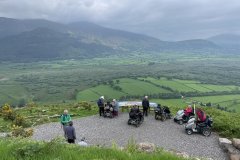
Whinlatter ‘WOW’ Trail – 17/05/2024. Before setting off we were welcomed by Whinlatter Forest staff and introduced to John Lewin, a Forestry England Volunteer, who was joining us on the ramble. The route today was mainly on the forest’s ‘WOW’ trail which starts with a steady climb to reach an area recently cleared of trees, opening up a view towards Keswick and Derwent Water. Here we stopped and listened to the bird song while John identified which bird was which. He also told us about the different species of trees within the forest and how to identify them. After a coffee stop at one of the forest’s viewpoints we continued through the forest, turning steeply downhill until we reached the forest bathing area, where a few walkers took advantage of lying on the wooden ‘bathing beds’ to relax and view the tree canopy. From here we made our way to the lunch stop at a magnificent panoramic viewpoint from where Bassenthwaite Lake, Skiddaw, Blencathra, Keswick, Derwent Water, Helvellyn and High Seat can be seen. The final part of our route was mainly downhill back to the Visitor Centre. Thanks to John for his input during this ramble. Thank you too Jim and Janet for towing the MSU all week and everyone who helped with loading and unloading the MSU and FSU and supporting the ramblers at gates and over rough terrain. Finally, thank you to Ron for organising such a wonderful and varied week of rambles. Marian & Barry
25 Photos
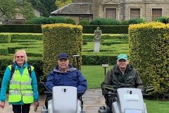
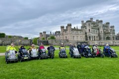
Lowther Castle and Park – 16/05/2024. Today’s ramble was led by Ian Jack from the Lowther Estate. Setting off from the car park we headed for the castle where we stopped for a group photo and Ian talked us through the history of the site and the Lowther family. From the castle we rambled out onto the estate and alongside the River Lowther, stopping periodically to hear more about the estate’s rewilding project, the deer and other wildlife. Leaving the banks of the river we continued uphill through the Whale Farm buildings, passing wild horses before entering an area of Lowther Park not normally open to the public. Here views over the Lake District Fells and the North Pennines started to appear. After our lunch stop at Park House the undulating route reached its highest point where Ian once again gave us a very informative talk about the prehistoric earthworks that were all around us. From here we started our descent, carefully navigating past a long horn bull, before reaching the car park. Thank you to Ian and Ron for a most interesting ramble. Marian & Barry
24 Photos
Coniston Water to Tarn Hows – 14/05/2024. On arrival we were pleased to see that parking spaces were reserved for us in the normally busy car park; not so pleasing was the rain - forecast for all day! After leaving the banks of Coniston Water we began the most challenging part of the day’s ramble, a steep and steady 500ft climb to Tarn Hows. Initially, the track was fairly flat passing alongside a babbling brook but on entering beautiful woodland the climb began, with several 1 in 5 sections and a couple of small fords. Towards the top of the track the surface became much rougher with several patches of large rocks but thanks to the volunteer helpers we all traversed safely. Views over Tarn Hows and the surrounding hills were limited due to the rain but nevertheless we knew we had reached some height. The ramble continued on an undulating track around the tarn after which we abandoned the proposed lunch stop at the viewpoint in favour of some respite from the rain in the National Trust exhibition barn at Tarn Hows. The descent initially started on a quite road before turning onto a grassy track with some challenging cambers. After passing through a herd very calm Galloway cattle and their calves a magnificent view of Coniston Water appeared in the valley below. On reaching Boon Crag Farm we rejoined our outward route with the weather having its last say with a torrential downpour! Many thanks to all the volunteers, the National Trust Rangers at Tarn Hows and Lake District National Park Authority for their assistance with this ramble. Marian & Barry
21 Photos
Great Langdale from Stickle Ghyll– 13/05/2024. Our route started from Stickle Ghyll Car Park and initially ran along the valley floor before crossing Great Langdale Beck at Oak Howe. From here we started to climb, stopping for a coffee break to take in views, before continuing our climb into Hag Wood where the bluebells were in full bloom. After rambling on through Baysbrown Farm we reached Elterwater Quarry, a slate quarry dating back to the mid-19th century. Leaving the quarry our route descended steeply between quarry spoil heaps to the banks of Great Langdale Beck and our lunch stop behind Wainwrights Inn. Our return route started on a rough track around Chapel Stile before opening out onto the valley floor with stunning views of the Langdale Pikes in front of us. Rambling alongside Great Langdale Beck and across fields scattered with ewes and their lambs we made our way back to Oak Howe, crossing the beck and back to the car park. Thank you to the National Trust at Stickle Ghyll and Langdale Estates for their assistance with this ramble. Marian & Barry
25 Photos
Tuesday 16-04-2024 Bellever Forest. The route begins by the River Dart and then goes uphill through the forest to open moorland. There are Bronze Age remains of stone houses, a burial chamber and stone rows along the route. The ramble ended with the presentation of the Wenman Trophy to Chris Southwood for her outstanding contributions to the work of the Disabled Ramblers.
14 Photos
Monday 15-4-2024. Okehampton Ring Road. Due to high winds, the route was shorter than normal. This is circular ramble following what is often called the ‘Okehampton Military Ring Road’ into the heart of Dartmoor. A very exposed route with a ford to cross. This road is part tarmac, part gravel some of it rocky and bumpy. This is an area used extensively by the military for army training and there are the remains of the old moving target railway line and Boer War redoubts. Some superb views across Dartmoor, a very quiet and tranquil spot often with only the sound of wind and birds.
9 Photos
