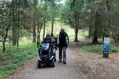
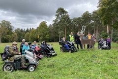
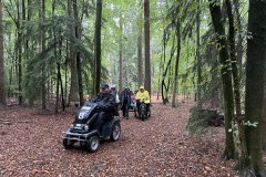
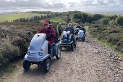
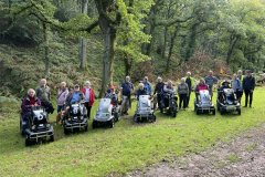
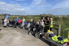
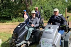
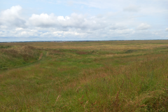
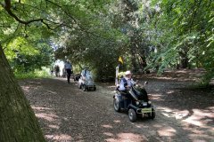
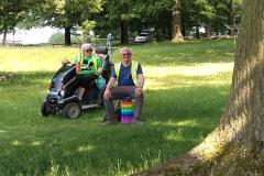
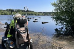
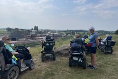
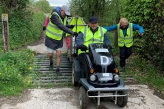
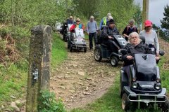
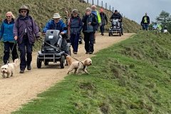
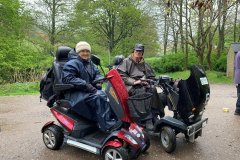
Fineshade Wood – Northamptonshire 18-102023. On our last ramble of 2023 the small group of 5 scooters and 2 walkers set off around the morning route with light cloud and no sign of the heavy rain which had been promised. Fineshade Wood is an ancient mixed broadleaf and conifer woodland with waymarked walks part of the Rockingham Forest in the north of Northamptonshire. Fineshade is known as the home of the East Midlands Red Kite project because of the previous RSPB presence at Top Lodge. We were lucky enough to see several Red Kites during the ramble. There is also a large herd of Fallow Deer moving through the woods, but we weren’t lucky enough to see any nor the Adders which can be usually seen on a warm Spring day. We stopped for lunch at the visitor centre and Bernard and Jan managed a game of table tennis to entertain us. As we set off for the afternoon ramble one of the scooters refused to move so Bernard and I free wheeled it back to Derek’s van where it stayed and had to be taken home for repair. We completed our day in a light shower and finished at the café for drinks and ice cream with the promise to meet up again in the Spring. Judy & Bernard
12 Photos
Lynford Stag - 13th October 2023 The final ramble of the week set off from Lynford Stag Car Park with seven scooters and seven walkers. Our route meandered through this area of Thetford Forest on a variety of tracks, and at one point off track to avoid a fallen tree across the path, before stopping for a coffee break not far from the artificial lakes near Lynford Hall. The ramble continued alongside the lakes with views though the trees of Lynford Hall and then onto Lynford Arboretum. The development of the arboretum commenced after the second world war when Lynford Hall became a Forestry Commission Training School. It has a fascinating collection of tree species planted by the trainee foresters. As we rambled through the arboretum, we wandered off track several times to take a closer look at the plaques hanging from the trees which provided information about the tree’s name and age. From the arboretum our route continued to the sandy banks of Lynford Water, an area of flooded gravel pits in the Wissey Valley, where we stopped for lunch before returning through the woods to the replica metal ‘Lynford Stag’ on the edge of the car park. Many thanks to all the volunteers who helped during the week. Marian & Barry. >>>>>>>>>>> Further Information: Following the Second World War, students from the Forestry England's training school based in Lynford Hall commenced planting species, primarily of interest to commercial forestry, but also other types of trees to see how they fair in Breckland conditions. The site chosen was part of the Victorian, and earlier, parkland which surrounds the Hall. Initially the Commission's arboretum was confined between Lynford road and the old water tower, this was extended south to the lake and in the early 1980's, east to the boundary of the military training area.
22 Photos
Brandon Country Park - 12th October 2023 Nineteen scooter riders and walkers set off from the Orchard Car Park at Brandon Country Park, the first of two rambles based in Thetford Forest. Our route started off through deciduous woodland and then onto a more open sandy trail before reaching a gravel road (apparently used for sled dog racing in the winter months) and our coffee stop at the MayDay Communication Tower. From here we continued through a thinned out area forest eventually leaving the gravel track back into thicker woodland where there were fungi aplenty. Our peaceful lunch stop was soon interrupted by the noise of a succession F15 jets taking off from RAF Lakenheath, home of USA 48 fighter wing. As the cloud base was so low, we only caught a couple of shadowy glimpses of the aircraft. After lunch we headed for an area of open heathland where, just before passing through the entry kissing gate, two roe deer crossed our path. Leaving Brandon Heath behind we arrived at a gothic flint knapped mausoleum surrounded by yews trees. It was built by Edward Bliss who also built the Grade II listed regency Brandon Park House and was responsible for planting an extraordinary eight million trees on his estate, creating much of what we know today as Thetford Forest. Our ramble finished outside Brandon Park House. Marian & Barry
23 Photos
10th October 2023. Built 400 years ago, Holkham Hall is still the home of the Coke family (pronounced (Cook). Thomas Coke, the 1st Earl Leicester, was an agricultural reformist who introduced the 4-year crop rotation system. The 8th Earl continues this tradition and has introduced a 6-year rotation. Regeneration of the land seems to have paid dividends with yields increasing as artificial fertilizers decrease – a system they call the ‘Wonder’. Our morning ramble took us past several large fields where we stopped to try to work out what crops were being grown – the plant identifier apps proving to be most useful. After lunch we made a circuit of The Lake and were delighted to get very close to some of the many Roe Deer, with the Stags in full antler. Another exceptionally sunny day. John C.
22 Photos
9th October 2023. Starting from Lady Ann’s Drive parking area at Holkham, our route to Wells-next-the-Sea took us through pine forest, part of the Holkham National Nature Reserve. At Wells, our tea break by the Lifeboat Station gave us the chance to marvel at the lifeboat and its launch tractor. A mile of walking along the sea wall brought us into the port. A section of road followed before we were back on the sea defence. A short steep bank took us down to a grassy area for lunch. A wonderful sunny day concluded with ice creams back at the Wells Beach car park before the last leg back to the cars. John C.
24 Photos
29/09/2023 Dowborough Hill Fort. At the start of our final day six scooter riders and eight walkers gathered for Shail’s briefing and Dan from the Quantocks Landscape Partnership Scheme was introduced. From the Great Woods car park, we retraced our route from yesterday passing Dead Woman’s Ditch up to Crowcombe Gate car park. Skirting the car park, we rambled to the triangulation point on Black Hill, from where we headed towards Hurley Beacon but unfortunately our way to the top of the beacon was thwarted by a locked gate. The views were clearer today in all directions as we continued along the ridge to Halsway Post. From here we continued to our lunch stop looking towards Dowsborough, the Iron Age Hill Fort, one of our expected destinations on our return route. Unfortunately, it wasn’t to be as Barry’s scooter decided it could go no further with a structural failure that meant it had to be loaded onto the FSU. As a group we made the decision to return to the car park by the easiest route. It was shame that this happened near the end of a wonderful week. This ramble week was challenging for both scooter riders and walkers but brought many rewards including wonderful views, the information shared about the area by staff from the Quantocks Landscape Partnership Scheme and the Quantock Hills ANOB and of course great company. Many thanks to Dan for supporting us with this ramble and to ANOB Ranger Andy who had supported Shail in the recce’ing of Dowsborough Fort and ensuring that part of the path to the fort was accessible. A special thanks to Andy and Tony, our towers for the week, and Chris and Cathy who were there every day to assist them. Thank you too to Shail and Paula for all the time and effort they put in to organising these rambles, making this such a successful and memorable week. Marian & Barry Andrews
21 Photos
28/09/2023 Ramscombe, Great Woods. At the start of the ramble Shail welcomed new member Andy and his partner and reintroduced Bill from the Quantocks Landscape Partnership Scheme to the group of seven scooter riders and ten walkers. Setting off from Great Woods car park we started our climb up through Ramscombe towards Crowcombe Gate car park. On the way we stopped at Dead Woman’s Ditch, a scheduled ancient monument, where Bill pointed out the linear bank and ditch which runs down into Ramscombe. After stopping for a break at the top of the combe, we rambled along the old drover’s road, a stunning path lined with beautiful beech trees and inhabited by ponies, one of which needed encouraging away from a gate so that we could make our way through. Beyond the gate the track became more rutted and very muddy, so we proceeded with caution to Triscombe Stone where we were again met by Quantock Hills AONB Ranger Andy. Triscombe Stone possibly dates from the Neolithic/late Bronze Age, or is the stump of a cross, and marks a meeting place on the old drover’s road. A field near the stone was our lunch stop and the group were given the option of remaining in the field or continuing with a steep ascent of Will’s Neck, the highest point on the Quantocks. A few chose to remain while the rest of us, guided by Andy, continued to the triangulation point at the top to take in the wonderful views, before descending to rejoin the others for lunch. After lunch it was a gentle trek through the pine trees of Great Woods back to Ramscombe. Many thanks to Bill and Andy for supporting us with this ramble. Marian & Barry Andrews
26 Photos
26/09/2023 Quantocks, Holford to Halsway and Bicknoller Posts. Today’s ramble was the first of three in the Quantock Hills. It was led by Shail - his first national ramble. In addition to the seven scooter riders and nine walkers we were joined by Bill and Jon from the Quantock Landscape Partnership Scheme and Tom and Ella, Scheme Apprentices. We set off down a track to Holford Bowling Green car park from where we began the steep and steady climb to the central Quantocks ridge. The climb set off through woods before we emerged into a more open area with views down towards the Bristol Channel and up to the ridge starting to appear. After stopping for a coffee break to catch our breath we continued upwards, with regular pauses to allow the scooters and walkers to recovery time! We stopped for an early lunch in the lee of the ridge and then rambled on to Halsway Post where we had wonderful views of the Brendon Hills, Exmoor and Dartmoor in the very far distance. We could also see the rain heading towards us which hit us as we moved along the ridge over Thorncombe Hill and Barrow which rather spoilt any further views. On reaching Bicknoller Post the rain had stopped, and we were met by Quantock Hills ANOB Ranger Andy, who was joining us to assist on our way down. Following recent heavy rain when parts of the path had been washed away, Andy and his team had carried out a great deal of remedial work to ensure that path was accessible for us. The descent started steeply into Ladies Edge, at the start of a quintessential Quantocks Combe. Halfway down we entered Hodder’s Combe, a beautiful and ancient oak forest. Here our challenges continued as we made our way through a couple of fords and along a stream bed before reaching Holford Bowling Green car park and the track back to the starting point at Alfoxton House. This was most definitely a Cat 3+ ramble, so many thanks to Bill, Jon, Andy, Ella, Tom and all the supporting walkers who helped make this very challenging ramble enjoyable and safe. Thanks also to the Buddist Centre at Alfoxton for allowing us to park in their grounds. Marian & Barry Andrews
39 Photos
25/09/2023 Steart Marshes, Somerset. On a gloriously sunny day, the first ramble of the week started off with a welcome to everybody including Jane and Jessica, two new members, and Laura and Dan from Somerset Film who had come along to film the first part of the ramble for the Somerset and Exmoor Coast Festival. As Paula was unable to lead the ramble, her apologies were given to the group. The welcome was followed by Ranger Nicole, who works for Wildfowl and Wetlands Trust, giving a short talk about the marshes and the bird life it attracts. Seven scooter riders and eleven walkers then set off towards the River Parrett, stopping briefly at Mendip Hide before reaching the banks of the river where we spent time with our binoculars and cameras watching out for what was going to be a day of trying to spot the fairly elusive birdlife! After leaving the river we rambled back to the information point, taking a coffee break at the ‘bug hotels’ area and then continued out across the marshes along and beside the seawall. On the seawall we paused periodically to watch an egret feeding on the marshes, a kestrel hunting overhead, swans with nearly fully grown cygnets, a heron patiently waiting by its hunting ground and ducks a plenty. We stopped for lunch on top of the seawall providing another view over the marshes. On our return journey Tony, one of our towers for the week, provided us with information about the construction work going on at Hinckley Point Power Station which dominates the skyline in this area, after which we continued along the seawall, stopping for another view across the marshes at a fully accessible hide before making our way back to the car park. Had it been high tide at the time of our visit, we might have had more success with our bird spotting as they concentrate closer to the hides. Thank you to Nicole for her support and introduction at the start and to Paula who had done the preparation work for this ramble. Marian & Barry Andrews
23 Photos
30/8/23 Salcey Forest, Northamptonshire A small group of 9 gathered and set off for our morning ramble through Salcey Forest, with the sunshine peeking through vast number of trees. At the crossroads of the trails we had our morning coffee stop, at a more open area where we felt the full warmth of the sun. It was good to see the many children, still on their summer holidays, enjoying the weather with us, walking, cycling and playing on the way around the area. We continued to the visitor’s centre café for lunch where we struggled to find a picnic bench owing to the number of visitors. After our lunch break, we set off again in the opposite direction across the road to a quieter area of the forest passing only a few walkers all the way before returning to the main part of the forest. Bernard was kept busy during the day with 3 tyres with punctures but fortunately we took the foot pump with us and we all made it back. Having thoroughly enjoyed our day together we sat with our ice creams to talk about where we might go for our next ramble. Judy & Bernard
8 Photos
Day 4 – Garwnant Forest Bannau Brycheiniog 21-07-2023 Sunshine on the final day of the week! We met up at the Garwnant Forest visitors centre car park for the last ramble of the week. The visitors centre has excellent facilities, with a changing places toilet and disabled toilets in the men’s and women’s toilets as well. It also has a very good café. There was a smaller group today, with 6 scooters and 9 walkers. We set off down the road and around the LLwyn-Onn reservoir, translated this means “ash grove”. The reservoir was quite a bit lower than when I had reccied in April, despite all of the rain over the last week. At one point you could see a bridge above the water. We stopped for coffee in a lovely picnic spot over looking the reservoir, before coming off the road onto forestry paths. It was a very pretty route meandering through the forest. We had lunch with views over the forest . After lunch the route took us passed Forest Lodge Holidays, where you can rent log cabins to stay in. The highlight of the day was the steep slope down into a valley where we had to cross a small stream, it was a lot wider and deeper when we reccied on the Saturday. We all got across and most of the walkers feet were still dry too! The end of a very enjoyable week of rambles. I would like to thank everyone for coming along and making it such a good week for us. I’d also like to say thank you to all the volunteers and helpers. Thank you to Marian, Martin and Pete for sending me all your photos during the week. See you all in Somerset! Paula
14 Photos
Day 3: Storey Arms to Libanus, Bannau Brycheiniog Thursday morning started from the Pont ar Darf National Trust car park. This is also the car park for the start of one of the routes up Pen y Fan, for those a bit more adventurous. The route we were doing today was a linear route. The car park was a little chaotic as there is still a lot of road works being done to create the car park. The site itself is very ecological in it’s approach, with a very strange long drop disabled toilet! We negotiated the roadworks and had a short section going up a footpath on the road passed the Storey Arms. This used to be an old drovers in, but is now an outward bound centre for children up to the age of 18. Once off the road we walked downhill towards Libanus. On the way, we were treated to a short talk on the geo landscape by one of our newer members Prof John Hunt. He talked about the mountains we could see on the other side of the A470 and the protalus ramparts (Protalus rampart - Wikipedia). It was fascinating to find out how they had evolved as well as informative. On the way back, it was a lot easier to see them. The talk inspired lots of discussions along the route, thank you John. The route was extremely rough with lots of culverts and ditches along the path. We had brought ramps to help smooth out some of them, but some were too big. I think I was probably the least bumped about on my scooter and there was probably a few aches and pains by the end of the day. We had lunch over looking the mountains and for once it almost, remained dry! The route was a reasonably short route, this was due to the terrain and also as we returned along the same path, it climbed gradually to 700ft. I wanted to make sure the walkers survived to the end! Another lovely day out, with thanks to all who attended and especially all the help from the volunteers on the day. Paula & Pete Brunt
26 Photos
Day 2 - Libanus Hill Forts 18-07-2023 Day 2 started from the Brecon National Park visitors centre. This was a figure of 8 ramble. In the morning we were going up to the hill fort Twyn Y Gaer above the visitors centre and then after lunch around the common on the other side of the road from the centre. Another good turnout of 24 in total. We had with us Abbi Flint from Newcastle University, she is doing research on historical rights of ways and was going to interview some of our members throughout the day. When Pete and I had done the reccy for this ramble at the weekend, we met a local farmer who gave us permission to visit a castle on his land called Camlais Castle. Unfortunately, we didn’t have time on the ramble to visit it, but before the ramble, he came along and gave a short talk on the castle and the area. The castle is a Norman castle and had been in his family since the 1500’s. It was very interesting to hear about its history. After this Francesca Bell from the National park welcomed us to the visitors centre and showed off their Terrain Rider which is slowly being rolled out to members of the public. Francesca also came along for a short walk before heading back to work! We set off across the common heading toward the hill fort. The area had changed dramatically since the reccy’s done in April. We were surrounded by large amounts of bracken. It was fairly easy going at the start and we had coffee by the hugging tree. After coffee we continued up to the trig point at the top. This was fairly steep going, but everyone made it. We had time for a few photos once the walkers had recovered! We returned back down to the visitors centre for lunch, when right on time it started to pour! After lunch we went over to the common this was reasonably flat compared to the morning although in places it was quite rutted. On our reccy last week, Pete and I had seen a Curlew, we had hopes of seeing it again but didn’t see it. However the area is abundant in Red Kites, Sky Larks and I saw quite a few Redstart too. There were plenty of sheep and I was very glad we have a trailer! We crossed Sarn Helen a disused Roman Road. Just before turning along the road, we were able to point out Camlais Castle in the distance. We then headed back to the visitors centre. We were lucky with the weather and it stayed mostly dry in the afternoon, credited to Ron as he had donned his waterproof trousers! Paula Brunt
25 Photos
Day 1 Usk Reservoir Bannau Brycheiniog Brecon Beacons) 17-07-2016 Our first ramble of the week was at Usk Reservoir. The reservoir is managed by Welsh Water and we were going to be doing a circular route through the Glasfynned Forest, the forest is managed by NRW (National Resources Wales). There was a good turnout of 23. We also had a couple of new members on this ramble, along with someone from the Brecon Local Access Forum- Karen. After a showery start along the road, we turned into the forest, going along nice wide paths. They were graded and easy going. We stopped off for our morning coffee in a pretty spot by a bridge over a stream. We were very spoilt by Heather & Martin’s homemade flapjacks and Karen’s homemade traditional Welsh cakes. They were both delicious. My pre bought offerings didn’t get a look in! We continued around the reservoir after we were refreshed and ready to go. This section was along narrower paths but still very good terrain. We skirted around the reservoir, every now and then getting fabulous views of the water below. We were in and out of the forest which was very welcome as the rain was very intermittent. Our lunch spot had lovely views of the reservoir. After lunch, we continued on to the dam wall. We were very grateful to Welsh Water, Jim & Sam for coming along and opening up the gate across the dam, this meant avoiding a steep road at the end. We trundled across the dam to the end of the ramble. Thanks to all the volunteers who helped make the day possible. It was a lovely day, despite the showers. Paula & Pete
29 Photos
29th June 2023 Regional Ramble at RSPB Wallasea Island Reserve Essex We had 3 people, all scooter users, on the ramble. Weather started with heavy rain but quickly cleared away leaving a bright and warm day. Before starting on the ramble the Warden, Simon Carpenter, gave us a brief introduction to the reserve and how it was created as a collaborative project between RSPB, DEFRA Cross Rail and others. The reserve lies between the river Crouch to the north and the river Roach to the south and east. From the car park the start was along a grassy but firm footpath on the northern sea wall with its glorious views of Burnham and the surrounding countryside. Then down the eastern side with its wide views across the whole of the reserve. Lunch was taken at the Half Moon Viewpoint out of the wind and overlooking the reserve. We then continued along the southern sea wall and on to the new Caroline's Hide in the centre of the reserve where we had our afternoon tea. During the day we enjoyed the glorious flora of the reserve with a great variety of grasses and other flowers all swaying in the wind giving the wonderful impression of movement. At the same time we had a great selection of birds including, in the distance, a Marsh Harrier. We also saw butterflies, moths, slugs, snails, hares and even several seals basking in the sun on the shore of the river Roach. At the end everyone said how much they had enjoyed the day and now that they know about this reserve and how accessible it is they will be back. It was also recognised that there are many route options within the reserve some short and some longer Thanks to everyone who came for making it such an enjoyable day. Leaders Cathy and Chris Nash
6 Photos
16/06/2023 Yes, it was hot again! Five wheelers and five walkers set off from the car park at Marbury Country Park to the banks of Budworth Mere and then on through ancient woodland, which was full of bird song, to reach the Trent and Mersey Canal. After crossing the canal, we rambled on to Dairy House Meadow where we had a break in the limited shade available attracting the attention of several bullocks who decided to join us – fortunately on the other side of a fence! From here our route took us through Anderton Nature Park until we reached the Anderton Boat Lift where we stopped for lunch before going to view the lift from below. As luck would have it, our arrival by the lift coincided with narrowboat Daedalus descending in the lift caisson from the Trent and Mersey Canal to the River Weaver Navigation, a decent of 50 feet. After seeing Daedalus cruising out of the lift onto the river, we began our return to Marbury Country Park via a different route. The ice van on car park at Marbury was a welcome sight at the end of a very hot week. Thank you to Rangers David & Melanie and Anderton Boat Lift for their assistance with this ramble. We would also like to thank Duncan, Paula and Bernard for all their help and all wheelers and walkers for making this such an enjoyable week. Marian & Barry
23 Photos
15/06/2023 Nine wheelers and seven walkers joined our ramble in Tatton Park which set off through woodland before entering the beautiful parkland. Our ramble continued alongside the Beech Avenue, planted in 1739 but now fenced off for conservation. Stopping for a break in the shade of a large oak tree also afforded everyone the opportunity to see and photograph the red deer bucks that were sheltering under the trees. On reaching the Knutsford Gatehouse we turned towards Tatton Mere and rambled alongside it before reaching our lunch stop in the woods overlooking the mere. After lunch we set off into a more remote part of Tatton Park where normally you see plenty of fallow deer but not today – they had more sense than to wander round in the blazing heat! We stopped off at an RAF memorial which commemorates No 1 Parachute Training School, which was based at Ringway (Manchester) Airport, in WW2. Tatton Park was used as a drop zone. The airport is in close proximity to Tatton Park so our day was punctuated by planes coming into land. Thank you to Tatton Park for putting out parking signs and organising a designated parking area and Ranger Darren for his support and providing gate keys. Marian & Barry
27 Photos
13/06/2023 Another hot day! Today’s ramble with eight wheelers and five walkers set off into the welcome shade of Delamere Forest, the largest wooded area in Cheshire with a mix of broadleaf and evergreen trees. Before long we could hear a cacophony of sound coming from the hundreds of birds on Blakemere Moss (lake) and individually we were able to venture down to the lakeside to see them. From the moss we rambled deeper into the forest where the tracks became more undulating, passing some more open sections from organised tree felling and replanting and an area that had been decimated by Storm Alwen in 2021, before making our way back to the Visitor Centre for lunch. In the afternoon we climbed steadily to the top of Old Pale Heights which gave us great views over the forest and beyond. Despite the heat we arranged ourselves around the central stone at the top of the spiral viewpoint for a group photo and then had the fun of disentangling ourselves before descending back to the Visitor Centre. Our thanks to Tracey at Delamere Forest, for all her support with and interest in with our ramble. Marian & Barry
19 Photos
12/06/23 We gathered for our first ramble of the week on the bank of the River Weaver Navigation, opposite the largest and oldest working salt mine in the UK – the biggest supplier of the natural rock salt used on our roads in the winter. Seven wheelers and four walkers set off along the riverside, passing pools created by the straightening of the river. The heat and humidity of the day was already building so our morning break was rescheduled to a shady area. The tow path had several poorly positioned open kissing gates which meant wheelers had to steer towards the river to get through! On reaching the Vale Royal Locks, Duncan, our MSU tower for the week, volunteered to wait with the FSU as we knew it wouldn’t go through a chicane further along the route. With the rest of the group successfully manoeuvring through the tight chicane we crossed the river alongside the busy Hartford Road bridge and started our return through Vale Royal Woods to our lunch stop back at the locks. After lunch we continued back along the riverside before turning to cross Weir Meadow and climbing up hill to Bostock Meadow. At the top of the hill, we stopped to take in the vastness of the mine with its busy workers and its stockpiles of salt. From here it was a slightly quicker ramble back to the start as the expected thunderstorms were rumbling around. Thanks to Ranger Tony for his assistance prior to the ramble. Marian & Barry
20 Photos
12/5/2023. Fernilee Reservoir We were fortunate with the weather today with no sign of rain. We were met by volunteer Rangers Margaret and Tony who walked the whole route and told us a great deal about the area. We set off from the car park opposite Errwood Reservoir uphill heading along the left side of the Goyt Valley towards the Fernilee Reservoir. We started off along the lane before turning off into the woods. We stopped high up overlooking the reservoir for coffee and were surrounded by hills and the beautiful scenery. On the downward rocky slope, where owing to the rain from previous days it was very slippery and progress was slow. Then continued safely through the grassy field, downhill to the next track where we stopped for lunch before crossing the bridge to the opposite side of the reservoir. We were very fortunate as Andy, the Ranger had organised one of his colleagues to meet us to unlock the gate saving us the tight squeeze through the pedestrian gate. Onward then uphill towards the sailing club and back along the road to the car park. Bernard and I wish to thank Phil and Julie (Mon & Tues) for towing the MSU and Geoff on Thursday and Friday. Also, to those who helped loading and unloading the MSU & FSU which include Martin, Heather, Pete and all of the members and guests who helped us throughout the week opening gates, crossing roads and through awkward sections, making our task easier and enjoyable. Judy & Bernard
16 Photos
11/5/2023. Longdendale Trail Today we welcomed Hannah from the Trans Pennine Trail who came to observe the ramble, take photos and videos and make notes for changes to improve the trail in the future. This included the access to the accessible toilets at the Torside car park and the first of the gates accessing the Longdendale Trail. We started our ramble with 10 scooters and 11 walkers with heavy grey cloudy skies which did drop some rain by the time we reached our coffee stop alongside the step waterfall on the bridge between the Torside and Rhodewood reservoirs. The rain made some of the rocky sections rather slippery especially for the walkers and then the sun came out again, but not for long. When we stopped for lunch alongside the Valehouse reservoir we had shelter under the trees just like a huge umbrella. After a leisurely lunch we crossed the bridge back to the Longdendale Trail and headed up a very steep section to turn left through the farm and back on the level trail returning to Torside car park at the end of the afternoon. All enjoyed themselves and thought the ramble round the reservoirs were lovely and well worth the visit. Judy & Bernard
18 Photos
9/5/2023. Derwent and Howden reservoirs. What a difference a day makes? Today we had a glorious day with lots of sunshine instead of all that rain yesterday, so our group thoroughly enjoyed the ramble and were able to benefit from the beauty of the area around the Derwent and Howden dams, known as the Lake District of Derbyshire. It was a long and hilly ramble in places today especially for the walkers but with frequent stops we really enjoyed each other’s company. The area had more visitors today than yesterday and we were frequently overtaken by cyclists and other walkers, but we managed to use the footpaths together without any conflicts. Lunch was a real delight alongside the dabbling River Derwent at Slippery Stones with the surrounding hills and the blue sky reflecting into the waters. We were all tired by the end of the day we are looking forward to our day off tomorrow. Judy & Bernard.
31 Photos
8/5/2023. Lady Bower reservoir. We started the ramble by heading towards the memorial to 617 Squadron known as the ‘Dam Busters’ who practiced their bouncing bomb raids before their sorties over Germany in 1943. Our group today of 8 scooters and 13 walkers started the week with a lot of rain up until lunch time then the cloud started to lift but by then we were really wet rambling along the side of the Lady Bower reservoir. We had our coffee overlooking the waters which covered the villages of Ashopton and Derwent when the dam was filled. Lunch was near to the road where we had to cross to avoid being splashed by the fast-passing traffic as they drove through the floods over the bridge. Fortunately, some drivers took pity on us and stopped well back to allow us to cross the road again as we headed back towards Fairholmes Visitor centre. Our thanks today go to Mike and Wendy who towed the MSU from East Yorkshire to meet new towers Phil and Julie in Derbyshire for their first 2 days with us and who took over the MSU for Monday and Tuesday. We also had help from Martin and Heather who helped ‘man’ the car park. Thanks also to walkers for their help in keeping us all safe. We look forward to better weather tomorrow, Judy & Bernard
10 Photos
21/4/2023. From Guisborough Forest & Walkway Centre we started along the same route as Monday but soon climbed through the woods, enjoying the pungent smell of wild garlic. After some time it became obvious that the track was impassable for Trampers, so we turned back (excellent three point turns!) to find an alternative. Passing through a meadow we made our way past the model village of Hutton, built originally to house local miners, climbing steadily in the company of two local dog walkers who knew the area. Unfortunately we were unable to follow the approved route to Highcliffe Nab as a horse stile had been installed with insufficient room to pass, so we continued upwards in the teeth of a stiff wind. Dropping down on a sandy track we found a more sheltered spot for a lunch break after which we slithered, waded and slid our way down to firmer ground. Back at the visitor centre, a cup of tea was most welcome. Remembering to change the spare wheel back (replacement for earlier flat tyre), everything was packed away following a most enjoyable week in the North York Moors. Mike & Wendy
28 Photos
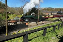
20/4/2023. This ramble followed the track of the original tramway designed by George Stephenson to transport iron from Goathland to Grosmont. The coming of the railway led to the demise of the tramway and it is now a pleasant walk between the two villages through beautiful countryside. Spring flowers and trees lined the route where there were glimpses of reminders of the iron making industry, now long gone. The final incline up to Goathland (Aidensfield in the TV series ‘Heartbeat’) was long and tiring, so everyone was relieved to arrive at the delightful village where we found a sunny spot to enjoy our lunch with nearby cafes providing coffee for those who wanted. The return journey took a short detour through the tiny beauty spot of Beck Hole where customers at the pub were interested to see us file by. The proximity of the heritage railway line afforded excellent views of the steam trains as they worked hard to climb the gradient on their way to Pickering. Finally returning to Grosmont we followed the road under the main line bridge to the car park among trees. Mike & Wendy
26 Photos
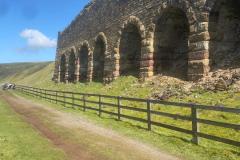
18/4/2023. After a short walk along the road from the Lion Inn on Blakey Ridge, we set out to follow the track of the old ironstone railway around the head of the Rosedale Valley. The scenery was spectacular as we travelled down the incline, passing the remains of the old water tower which replenished steam engines on their way uphill. Rounding the head of the valley we found a sheltered spot for coffee with far reaching views, after which the track levelled out, taking us along the far side towards the old lime kilns. Explanatory boards showed how the workings progressed. Ironstone has been mined here since the Middle Ages, and in the 19th century it expanded so much that a standard gauge railway opened in 1861 to take the ore to Teesside. The ironstone rock was calcined in the kilns to reduce the waste, which made it cheaper for the ore to be transported. The two sets of kilns were truly massive and must have been an awesome sight when in use, belching smoke and flames. Seated beneath them at lunch time we felt quite small. The wind on this side of the valley was somewhat brisk as we turned for the return journey. The surroundings afforded many glimpses of the local wildlife including rabbits, buzzards and a pool teeming with life in the form of tadpoles. The floor show was provided by a farmer and his dogs rounding up some of the free ranging sheep. After a few problems struggling up the incline (no water needed as we weren’t in steam) we regained the road and soon reached the welcome shelter of the Lion Inn once more. Mike & Wendy
35 Photos
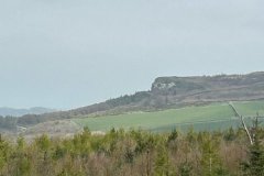
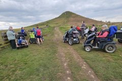
17/4/2023. Leaving the Forest and Walkway Visitor Centre we began by following the track-bed of the Guisborough Railway Branch Line, but soon left this to climb through the woods, quite steep in places. Exiting onto Roseberry Common we stopped for our coffee break at the foot of the distinctive conical Roseberry Topping. No one was brave or foolish enough to attempt the ascent on this occasion, but the view was great and several hikers and cyclists stopped to chat. Continuing on towards Aireyholme Farm we were confronted by a sea of mud where farm machinery had churned up the track. Bravely battling (and sliding) downhill we arrived in the farmyard amused by the sight of two sheepdogs sitting in an off-road vehicle as if ready to drive off with their trailer load of sheep. This was the childhood home of Captain Cook and our lunch stop near the pond. Returning past Roseberry Topping we turned away from our outward route to pass Bousdale Farm where a very steep descent took us back to the woods and the café by the car park, just in time for a welcome cuppa. Mike & Wendy
21 Photos
